Hydrology · Remote Sensing · Machine Learning

Parisa Abbasalizadehrezaei

Environmental engineer turning satellite data and water models into decisions for water management.

SCROLL ↓

About

Water, satellites and data.

I'm an environmental engineer (MSc, Sharif University of Technology) working at the interface of hydrology, satellite remote sensing and machine learning. I build Earth-observation workflows in Google Earth Engine and Python, model surface water and groundwater with WEAP, MODFLOW and MIKE, and turn model results into decision support for water management.

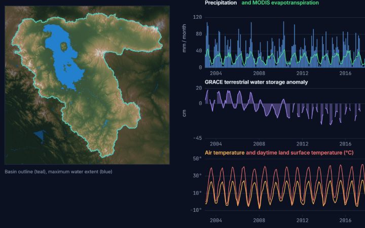
My work on a decision-support system for the Lake Urmia basin, carried out with the University of Delaware, is published in the Journal of Hydrology and was presented at AGU24. I also have hands-on experience in water-quality laboratory analysis and review regularly for Elsevier journals.

44Peer reviews for Elsevier journals
+31%Environmental water supply in optimized allocation scenarios
17.71/20MSc GPA, Sharif University
AGU24Conference presentation, Washington, D.C.

Skills

Tools and methods.

Remote sensing

Google Earth Engine (JS & Python)LandsatSentinel-2Spectral & water indicesLand-cover classificationChange detectionAccuracy assessmentENVI

Machine learning & data

PythonpandasNumPySciPyscikit-learnMatplotlibRandom ForestGradient BoostingK-meansTime-series analysisR (basic)

Hydrology & groundwater

WEAPMODFLOWMIKEWater balanceScenario analysisMulti-objective optimization

GIS & data management

ArcGIS / ArcGIS ProQGISMap productionReproducible workflowsGit / GitHubHPC (basic)

Water quality

NutrientsBOD / CODAlkalinityHardnessColiforms

Languages

English – fluent (TOEFL iBT 90)Persian – nativeGerman – basic

Projects

Research and engineering projects across water resources and Earth observation, each linked to the open-source code that reproduces its methods.

Live demo · Earth observation

Global Wetland Water-Area Trends, 1984–2025

Forty years of Landsat surface-water area for nearly 600 lakes and wetlands. Colour shows each water body's long-term trend; click a point to see its annual water-area curve and fitted trend.

Open full screen →
Live demo · Earth Engine app

GSW Lake Explorer: Lake Razazah, 1984–2021

A public Earth Engine app running inside this page. It opens on Lake Razazah (Iraq), which lost about three quarters of its permanent water between 1984–1993 and 2012–2021, with its yearly JRC Global Surface Water animation, area chart and decade comparison. Click any other lake on the map, or search a name, to explore it. The frames take a few seconds to render.

Open full screen →

Research projects

7 projects · each linked to related code
Inflowforecast Demands &scenarios WEAPdaily balance MOEA+ AHP +31%env. water +26%agri. profit
Water resources · Decision support

Decision Support System for the Lake Urmia Basin

University of Delaware (remote) · 2023–2024 · Journal of Hydrology 2026

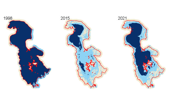
A forecast-informed decision support system for real-time water allocation, coupling a daily WEAP water-balance model with inflow forecasts. Multi-objective evolutionary optimization and AHP were used to compare scenarios; optimized strategies raised environmental water supply by 31% and agricultural profit by 26%.

WEAPOptimizationAHPForecasting
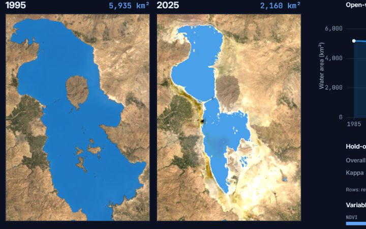
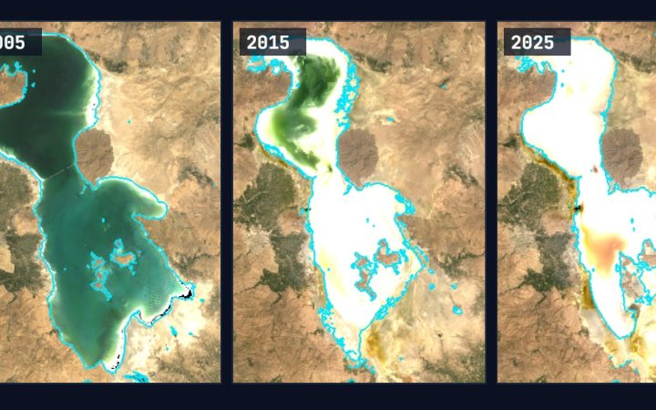
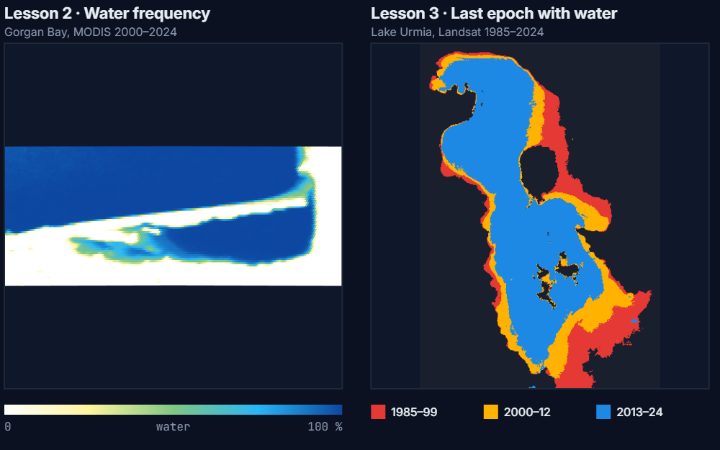
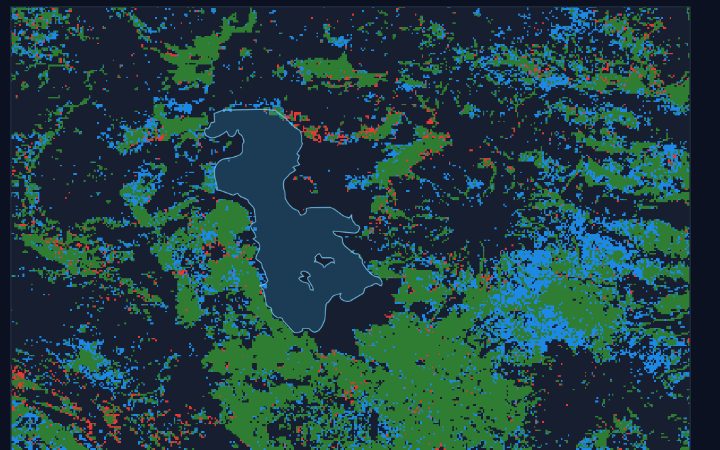
Lake Urmia water maps classified with Random Forest
Earth observation · Machine learning

Wetlands Monitoring System

Sharif University of Technology · 3-year funded grant · 2021–2023

Multi-year satellite monitoring workflows (Landsat, Sentinel-2) for surface water and land cover in Google Earth Engine and Python, using Random Forest and K-means for classification and change detection, with full accuracy assessment.

Google Earth EngineSentinel-2LandsatRandom Forest
reservoirdamriverwater tableMODFLOW grid · leakage → aquifer → river
Groundwater

Dam Leakage & Aquifer Response

MSc project

MODFLOW simulation of dam leakage and aquifer response to an adjacent river, with analytical and numerical solutions implemented in Python.

MODFLOWPython
t₀t₁t₂ MIKE hydrodynamics · advection + spreading
Hydrodynamics

Oil-Slick Transport in the Karkheh Reservoir

MSc project

Hydrodynamic modelling of oil-slick transport in the Karkheh reservoir using MIKE.

MIKETransport modelling

Open-source tools & tutorials

github.com/RisaRezaei ↗

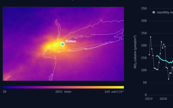
Everything below is my own code, public on GitHub under the MIT licence. Each tool has a tutorial page with its demo output, the method, and a step-by-step walkthrough of the source.

@RisaRezaeipublic repositories on GitHub
12public repositories
11Earth Engine tools & course
2Python command-line tools
2,446lines of documented code
Techniques in the codeCloud masking & QA bitsMulti-sensor harmonisationRandom Forest (classification & regression)Accuracy assessmentSen’s slope & Mann-KendallZonal statisticsTime-series compositingUnit conversionBatch exportsPython CLIsrasterio / GeoPandasResumable API downloads

Publications & Peer Review

Selected outputs.

Journal article · 2026

Meydani, A., Abbasalizadehrezaei, P., Javadian, M., Khodaei, H., Tajrishy, M., Levia, D.F. (2026). Scenario-driven decision support system for assessing water balance to support agricultural and ecosystem sustainability. Journal of Hydrology, 665, 134679.

doi:10.1016/j.jhydrol.2025.134679 →
Conference · 2024

Abbasalizadehrezaei, P., Meydani, A., Khodaei, H., Tajrishy, M., Levia, D.F. (2024). An integrated decision support system for balancing agricultural and environmental water use in the Urmia Lake Basin. AGU24 Annual Meeting, Washington, D.C.

Peer review · 12/2024 – present

44 reviews for Elsevier: Journal of Environmental Management (35), Agricultural Water Management (8) and Journal of Hydrology (1), covering hydrology, remote sensing and water management.

Experience

Research and teaching.

Research Collaborator, University of Delaware, USA (remote)

09/2023 – 12/2024 · Prof. Delphis F. Levia, Prof. Massoud Tajrishy

  • Co-developed a forecast-informed decision support system for real-time water allocation in the Lake Urmia basin, coupling a daily WEAP water-balance model with inflow forecasts.
  • Applied multi-objective evolutionary optimization and AHP to compare allocation scenarios; optimized strategies raised environmental water supply by 31% and agricultural profit by 26%.
  • Results published in the Journal of Hydrology and presented at AGU24.

Teaching Assistant, Water Environment Analysis Laboratory

Sharif University of Technology · 02/2023 – 04/2023

  • Guided students through water-quality and hydrochemical experiments and assessed their lab reports.

Research Assistant, Sharif University of Technology

04/2021 – 04/2023 · Development of a Wetlands Monitoring System (3-year funded grant)

  • Built multi-year satellite monitoring workflows (Landsat, Sentinel-2) for surface water and land cover in Google Earth Engine and Python.
  • Applied Random Forest and K-means for classification and change detection, including accuracy assessment.

Education

Degrees, distinctions and training.

MSc, Environmental Engineering

Sharif University of Technology, Tehran · 09/2020 – 04/2023 · GPA 17.71/20

Thesis: satellite-based assessment of surface water using Random Forest classification, K-means clustering and spectral indices in Google Earth Engine.

BSc, Civil Engineering

Kharazmi University, Tehran · 09/2016 – 07/2020

Distinctions
  • Member of the winning team for the 3-year grant "Development of a Wetlands Monitoring System", Sharif.
  • Ranked 1st in Groundwater Contamination, Advanced Hydrology and Water Environment Analysis Laboratory (MSc).
  • Elsevier reviewer recognition: J. Environmental Management, Agricultural Water Management, J. Hydrology.
Workshops
  • Remote Sensing for Water Accounting Plus (WA+), IHE Delft (2021)
  • Remote sensing with Google Earth Engine, UNESCO Chair workshop (2020)

Contact

Open to research, data and engineering roles and collaborations across Europe.

Email

risarezaei@gmail.com

LinkedIn

linkedin.com/in/risarezaei

ORCID

0009-0009-5708-7673

GitHub

github.com/RisaRezaei